If you try to “google” to find out from the internet source the key differences between a “Hill” and a “Mountain”, the most common answer is ” there is no distinct difference”. Even the United States Geological Survey (USGS) concludes that these terms don’t have technical definitions and no scientific consensus exists to determine if a person is looking at, standing on, or merely regarding a mountain or a hill.
I find it hard to clearly define a hill from a mountain. Let’s take Poon Hill, a popular destination in the Annapurna region of Nepal, and Gunung Lambak as examples. The highest point on Poon Hill is at 3210m, while Gunung Lambak’s (Kluang, Malaysia) highest point is at 510m. The height disparity is great. Yet, Gunung Lambak is called a “Gunung”. Gunung is the Malay and Indonesia word for mountain. If I will to make comparison of the terrain of both, I dare say that Gunung Lambak has a more challenging terrain than Poon Hill. The challenge of Poon Hill lies in the wind, cold and altitude, the final walk up to the peak is by far a “walk-in-the-park” as compared to walking up Gunung Lambak. Having said that, both peaks offer different spectacular views and are attractive in its own merit.
So, let me come to my point. The height of a mountain or a hill will not determine its level of difficulty, the terrain does. If you are looking for a “tougher” day trek in our region, other than our very own Bukit Timah Hill, Gunung Lambak offers sufficient challenge for us. Gunung Lambak is in Kluang, a small town in the Johor State of Malaysia, about 2.5hrs drive from Singapore. Because it is so near to Singapore, many trekkers would either self drive up to Kluang, or take a KTM train from Woodlands to Kluang station. For us, we organise a group and hire a van to bring us to the foothill.
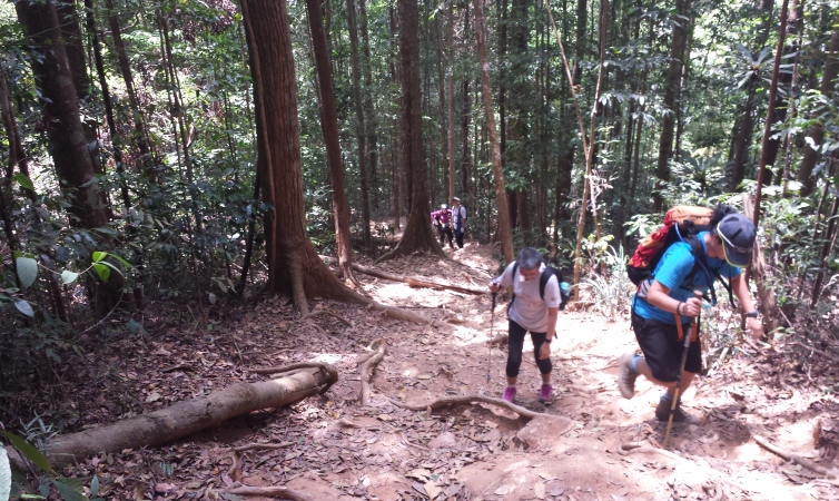
There are 2 or perhaps 3 trail heads leading to the summit of Gunung Lambak, and at the foothill is a resort for holiday goers. We set off the trail with a stream next to it, and made steep ascent on undulating rocks to reach a rest point with huge signboards. Beyond the rest points, there are 2 ways to get to the summit. One is a steep vertical long ascent with plenty of scrambling to do, another is a gradual slope which covers a longer distance. We took the steep rock scrambling trail, and descent via the gentler slopes.

Tarmac road leading from the resort path the way to the trail head
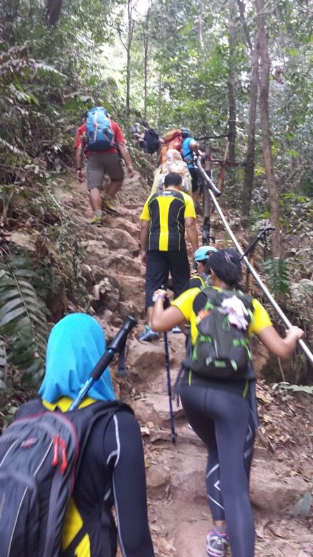
The tarmac path leads to a steep rocky ascent almost like climbing a staircase

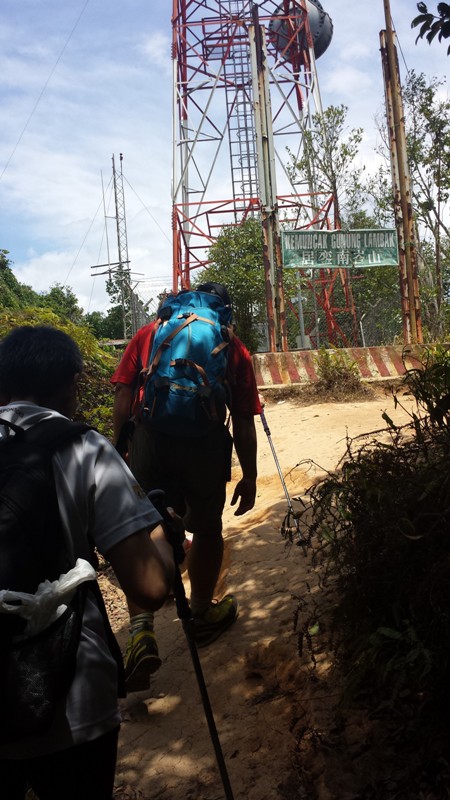
Greeted by a huge sign board showing the distances. By now, 1.5km of trail has been climbed.

An open area with another huge signboard of Gunung Lambak

Steep rocky terrain. The ropes are fixed and maintained by the climbing association of Kluang.
The steep and narrow rock trail opens up to the slopes leading to the summit.
Reaching to the top of Gunung Lambak

A clear view from the summit of Gunung Lambak.

A team shot up there.
As you can see, the terrain is definitely challenging for a 510m hill (or a mountain). It doesn’t matter if you are a seasoned trekker or a newbie, it takes courage to attempt a challenge, and courage comes from the heart.
Gunung Lambak is a good mountain to climb to experience trekking in a forested area, many seasoned trekkers travel to Kluang to climb Gunung Lambak as part of their training regime. Locals climbed it to keep fit. You can do it too, whatever reasons you have to want to climb.
Our next Gunung Lambak trek will be held on Sat, 31 May 2014. Contact us at contact@aceadventure.com.sg.
Hill or Mountain? you decide.
~ Joanne Soo
